

Geospatial Annotation Services for HD Maps, ADAS & Smart Infrastructure
Engineering-grade annotation for autonomous driving, infrastructure mapping, and AI training datasets — delivered at scale under TISAX and ISO 27001 certification.
What It Is
ASPL provides geospatial annotation services and geospatial data labeling for AI and mapping teams working with spatial data. Our seven core competencies cover geospatial data processing, GIS mapping and visualization, spatial analysis, LiDAR and point cloud processing, geospatial annotation and labelling, BIM and GIS integration, and GIS automation. We apply these across HD road networks, LiDAR ground truth, satellite imagery, cadastral mapping, utility network and building footprint extraction, and road asset extraction.
Industries Served
- Autonomous Driving & ADAS
- Location Intelligence & Mapping
- Infrastructure & Utilities
- Telecom & Broadband Expansion
- Environmental & Urban Planning
Key Capabilities
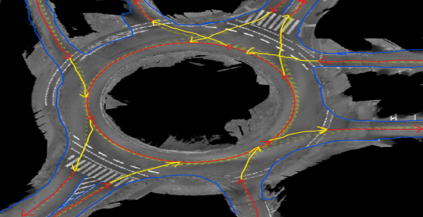
HD Map Annotation Services & Road Network Mapping
Polyline annotation for lane borders, centerlines, and intersection geometry on HD scans, built for ADAS development and autonomous driving perception. Output formats include SVG, GeoJSON, and Shapefile.
Delivered
5,500 HD scans, 30-40 polyline classes, automotive Tier-1
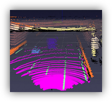
LiDAR Annotation Services & Point Cloud Processing
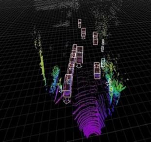
Ground, building, and vegetation classification on georeferenced LAS/LAZ point clouds for autonomous driving and ADAS perception systems. Includes 3D feature extraction, point cloud classification, ground truth annotation, and LiDAR data visualization.
Delivered
800 sq km of LiDAR classification for a Tier-1 customer.
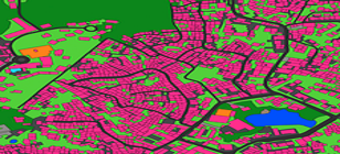
Satellite Imagery Annotation & LULC Classification
Land use / land cover segmentation, including agriculture and crop-land classification, building footprint extraction, and thematic mapping on Sentinel-2 and Landsat 8 sources.
Delivered
600–800 sq km of seven-class LULC mapping at > 90% classification accuracy.
Cadastre & Parcel Mapping
Digitization of land parcels, property boundaries, survey numbers, and ownership attributes from survey maps, satellite imagery, and GPS data. Outputs include shapefile, geodatabase, and DXF.
Delivered
District cadastral mapping with topology-validated outputs at >90% accuracy.
Road Asset & Utility Network Mapping
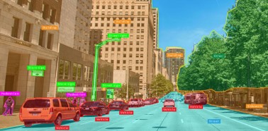
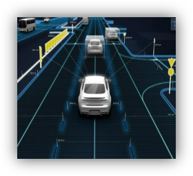
3D asset feature extraction (gantries, signs, signals, illumination, telematics) and 2D vector annotation of water, sewer, storm, and telecom networks.
Delivered
35-annotator team delivering ≥98% quality for a Portugal Tier-1; 150–200 utility plan sheets digitized at sub-metre precision.
GIS Automation
Python-based automation using ArcPy and PyQGIS for repetitive GIS tasks, spatial analysis, geospatial dataset management, automated map generation, and custom workflow plugins.
Delivered
Custom ArcPy and PyQGIS workflows deployed across multiple production programs.

BIM & GIS Integration
IFC-to-GeoJSON conversion, georeferenced BIM layer export, and spatial attribute enrichment from cadastral and utility GIS datasets. Workflow covers LiDAR point cloud to 3D mesh, BIM model generation, IFC export, GIS coordinate registration, and clash detection for as-built verification.
Delivered
BIM and GIS integration for a real estate developer and infrastructure planning client, covering as-built verification, smart city digital twin development, and clash detection between structural, MEP, and spatial GIS layers.
How It Works
Data Collection
Spatial data gathered from satellite imagery, LiDAR, drone, mobile mapping, and survey sources.
Data Pre-Geoprocessing
Coordinate system management, data cleaning and transformation, integration of multiple geospatial datasets.
Feature Extraction & Digitization
Manual annotation supported by Pixeal-powered automation — polyline, polygon, 2D/3D bounding box, and semantic segmentation.
Spatial Analysis
Buffer, network, terrain, elevation, proximity, and overlay analysis as required by project scope.
Quality Control (QA/QC)
Project-scaled QC structure: 2 dedicated Quality Analysts per 10 annotators. Thresholds set in SOW.
Map Production & Delivery
Datasets delivered in client-preferred formats — GeoJSON, Shapefile, LAS/LAZ, SVG, DXF, KML — with version control where required.
Use Cases
HD Map Creation for Autonomous Vehicles
Lane-level polyline annotation, intersection geometry, and road markings on HD scans. 5,500 HD scans with 30–40 polyline classes per scan, delivered in SVG format for an automotive Tier-1.
LiDAR Ground Truth for ADAS Perception
Ground, building, and vegetation classification on georeferenced point clouds. 800 sq km classified for a Tier-1 automotive customer.
Road Asset Inventory & Infrastructure Mapping
3D feature extraction of road furniture from high-density LiDAR. 35 annotators + 7 QC + 2 Team Leads delivering ≥98% quality for a Portugal Tier-1.
Land Use / Land Cover Mapping
Multi-class classification on Sentinel-2 and Landsat 8 imagery. 600–800 sq km across seven LULC classes at >90% accuracy.
2D Building Footprint Extraction
Building outline extraction from sub-urban aerial imagery. 1,000+ sq km delivered as shapefile outputs for a Tier-1 customer.
Utility Network Mapping
Water, sewer, and storm infrastructure digitization from engineering plan sheets. 150–200 plan sheets at sub-metre precision.
BIM & Digital Twin Integration
UAV/drone orthophotos, LiDAR point clouds, and architectural drawings (DWG/IFC) integrated with cadastral GIS layers for a real estate developer. Output delivered as IFC + GeoJSON and a 3D web viewer, supporting smart city digital twin development and construction progress monitoring.
Benefits
Audit-ready compliance
TISAX AL3, ISO/IEC 27001:2022, ISO 9001:2015, ISO 14001:2015, and EU GDPR — relevant for German automotive teams and EU clients with data-residency requirements.
Engineering-grade accuracy
≥98% on Portugal Tier-1 road asset extraction; >90% across LULC, cadastre, and tree health programs; sub-metre precision on utility network mapping.
Proven scale
5,500 HD scans on a single road network program. 1,000+ sq km of building footprint extraction. 800 sq km of LiDAR ground truth.
Multi-jurisdiction delivery
Sales presence in Munich and Singapore. Five India delivery centres — Bengaluru, Tamil Nadu, North Karnataka (two sites), and Odisha.
Pixeal-powered automation
Proprietary platform for AI-assisted pre-labeling and validation, combined with expert human review.
Deep toolchain coverage
ArcGIS, ArcGIS Pro, QGIS, MicroStation, AutoCAD Map 3D, CloudCompare, Inkscape, ArcPy, and PyQGIS — covering automotive, civil, survey, and utility workflows.
Why ASPL
- TISAX, ISO 27001:2022, ISO 9001:2015, ISO 14001:2015, and GDPR certified
- 5 Automotive Tier-1 customers, 4 AI technology companies, 3 engineering service providers
- Pixeal-powered automation combined with expert human validation
- 400+ FTE including 300+ annotation specialists and an AI/ML/DL team of 40
- Five India delivery centres for redundancy and scale
- 10+ documented case studies spanning LULC, cadastre, HD mapping, LiDAR, and asset extraction
Frequently Asked Questions
What is geospatial annotation?
What are LiDAR annotation services?
Is ASPL TISAX certified?
What file formats do you deliver in?
What accuracy do you commit to?
What tools does your team use?
Where are your delivery centres?
What does Pixeal do?
Do you provide BIM annotation for digital twin and smart city projects?
Whether you're training a perception model, building HD maps, or digitizing infrastructure
Talk to a geospatial lead about your program requirements.
Get in touch